Friday, July 20, 2007

A Vision of Buffalo Bayou


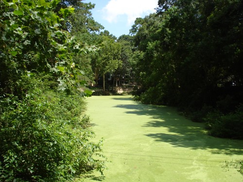
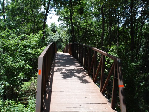
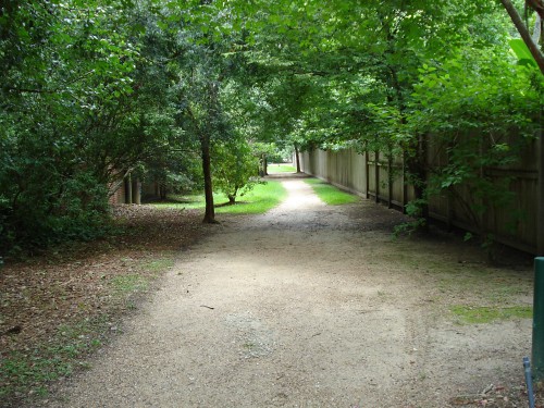
I wanted to follow up on the Terry Hershey excursion. First of all, in case I didn't make it quite clear, Terry Hershey Park is a jewel that should be treasured by Houston. The same can be said of its inside-the-loop counterparts, Buffalo Bayou Park and the other parks near downtown that border the Bayou. One of these days I'll explore them by bicycle for this blog. I have, of course, ridden there many times before, but in recent years they have built a lot more onto the parks, and the trails extend through downtown (I believe). The Buffalo Bayou Partnership has been planning and building these changes for years, and they plan to turn the Bayou into a park all the way to the turning basin of the Ship Channel (which is where the natural bayou ends and the man-made bayou begins).

The Buffalo Bayou Partnership
has a 20-year plan for the Bayou which will turn it from the generally neglected smelly muddy creek it has been for just about forever into a cool, civic area where people live and play. The plan is quite specific in many areas, and very vague in others. One of those vague areas is to connect Memorial Park to Buffalo Bayou Park in some way. This is an extremely exciting idea to me, and one that seems doable if you just look at a map. The distance along the Bayou between those two parks is only about a mile.

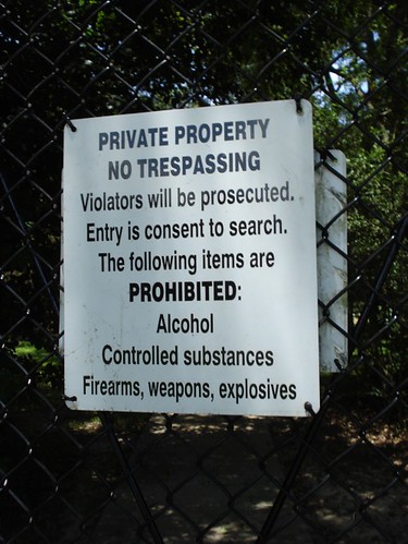
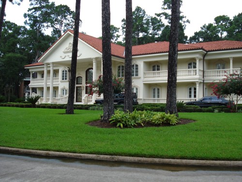
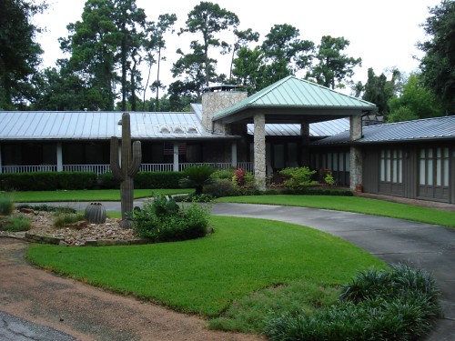
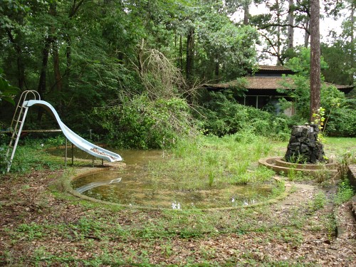
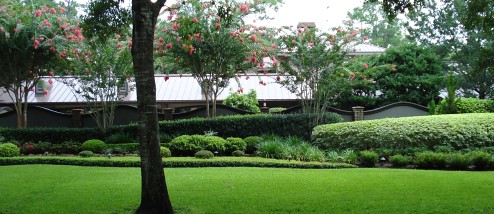
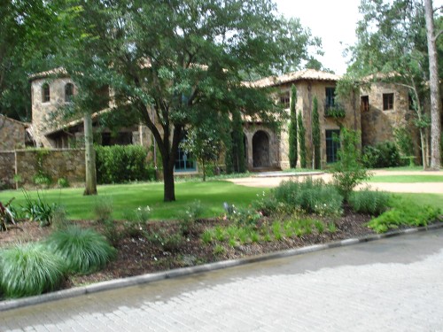
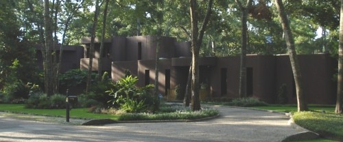
However, that mile includes the River Oaks Country Club and some of the most expensive private homes in Houston (according to Zillow.com, the cheapest property along that stretch of the Bayou is $401 thousand while the most expensive is a whopping $9.16 million). That said, there is Bayou Bend, which is a large mansion on the Bayou now owned by the Museum of Fine Arts. One assumes that they would not be opposed to a bike path along the Bayou, assuming they could control access to the gardens and the mansion. That would take care of a big chunk of the mile of Bayou between Memorial Park and Buffalo Bayou Park.

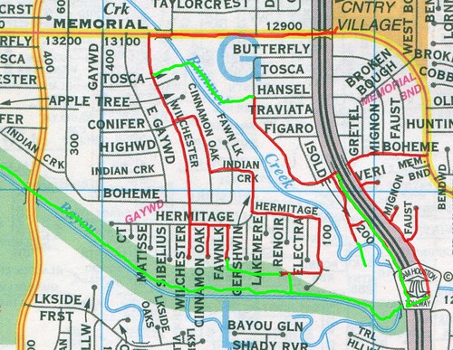
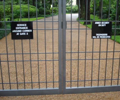
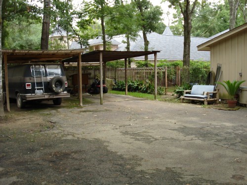
The much more difficult task would be acquiring Bayou front land between Terry Hershey Park and Memorial Park. The Bayou leaves the western edge of Memorial Park at the point where the Bayou crosses Woodway, just west of the 610 Loop. Then, as far as I can determine, there are no public Bayou frontages until you reach Terry Hershey Park at the Sam Houston Tollway. So if Harris County wanted to have a hike and bike trail along that area, they would have to condemn and buy millions of dollars worth of property along the Bayou. Property that belongs to wealthy, politically connected people.

In theory this is possible, but I can't imagine a scenario where it would be worth the combination of money and political will required. But let's assume we could somehow acquire property along that length of the Bayou (and along the mile of River Oaks Bayou frontage we'd need).

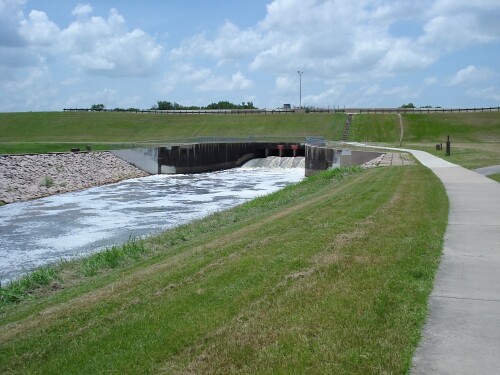
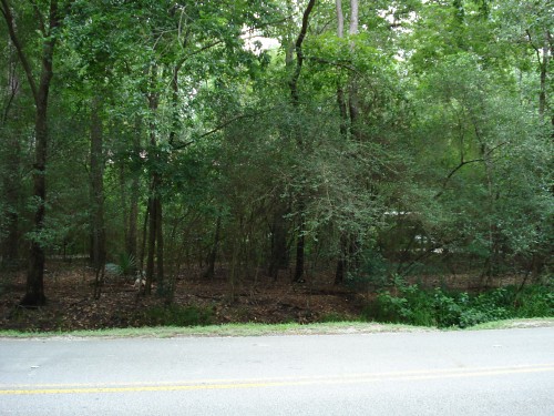
At that point, Terry Hershey accompanies the Bayou out past Highway 6, then behind the Addicks Dam, the Bayou runs through George Bush Park, which is enormous. The Bayou leaves George Bush Park a little past where it crosses the Westheimer Parkway, at which point it becomes a wide, channelized stream with ample space on either side for a hike and bike path. I believe the Bayou's official starting point is in West Katy, near the Katy-Flewellen Rd., some 35 miles from downtown Houston.

Now imagine a continuous hike and bike trail running from that starting point all the way to the turning basin. I called Terry Hershey Park a jewel. A park/hike-and-bike trail from west Katy to the turning basin along Buffalo Bayou would be the crown jewel of Houston and Harris County. It would be one of the great urban parks in the world. What is amazing is that huge sections of it are already built, and more large sections (along Memorial Park and George Bush Park) would require no land acquisition. Unfortunately, I can't see how it could be done. It would require, in essence, opening up the back yards of Houston's elite to hikers, bikers, joggers, strollers, and other hoi polloi. I can't realistically see that happening. But I can dream.

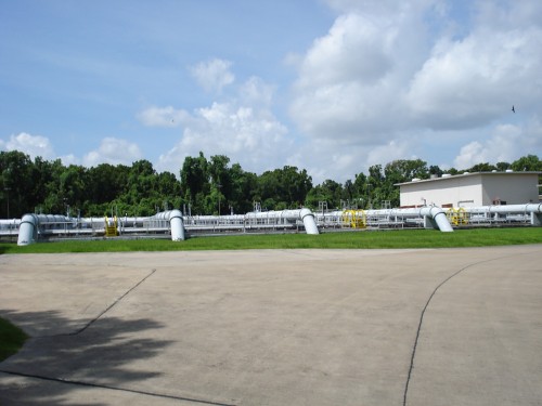
(Photo credit. I borrowed this photo without permission from this site. The photographer is Billie Mercer, and I like his photos very much. He has quite a few more of Buffalo Bayou and also of the Sixth Ward neighborhood.)

Labels: ,

Friday, July 13, 2007

Houston Streets 6


Yesterday I decided to take a break from exploring the Villages, and indeed from exploring the streets at all. It has always been my intention to look for all the paths a bicycle can take, even if a car can’t. That includes the little cut-throughs I’ve found in the Villages, but also short cuts through business parking lots, footbridges, and, of course, hike-and-bike paths. Perhaps the single best bike path in Houston is in Terry Hershey Park. The map above is from their website, but to really see this map in its full glory, I encourage you to click through.

Terry Hershey Park runs along Buffalo Bayou from the Sam Houston Tollway to Addicks Dam just west of Highway 6. It includes two spurs, one reaching north to I-10 and one reaching south of Briar Forest. Terry Hershey Park was once owned by the Army Corps of Engineers as part of the Addicks flood control for the Bayou, and was later donated to the county. Terry Hershey was a conservationist who worked hard to make sure that Buffalo Bayou was not channelized like Brays Bayou and White Oak Bayou, both of which have been turned into charmless concrete ditches, but both of which have nice bike paths on them.

http://farm3.static.flickr.com/2002/2177429763_d431f7b1de.jpg?v=0

The trail starts on the east side of the Sam Houston Tollway, but I encountered a problem almost instantly. The Bayou is still running very high from the recent rains. The trail dips low under the freeway—with the result pictured above. The flooded part was just too deep for me to ford. I tried! So I had to go back into the neighborhoods north of the bayou and see if there was another way to access the park.


http://farm3.static.flickr.com/2380/2177430171_be1ee176a9.jpg?v=0

As you can see, I had to explore quite a bit to figure out a way to return to the bike path. (The green lines show paths inaccessible by car.) That said, there are numerous ways to get to Terry Hershey Park—it is accessible from any number of streets and cul-de-sacs on both the north and south sides of the bayou.


The image “http://farm3.static.flickr.com/2337/2177430311_d88fefd7a3.jpg?v=0” cannot be displayed, because it contains errors.

Still, it took a lot of exploring for me to find access to the bike trail. First I stumbled across this immense water treatment plant (which was accessible only by going to the end of nondescript suburban cul-de-sac, squeezing through a gate that one was obviously not meant to squeeze through, and crossing a one lane bridge). I later discovered that the trail runs just behind this plant, but I couldn’t find a way to get from the plant to the trail. So I kept searching.


The image “http://farm3.static.flickr.com/2185/2177430823_8d1f8d023a.jpg?v=0” cannot be displayed, because it contains errors.

I then found an entrance into the Edith L. Moore Nature Preserve. This bird sanctuary is criss-crossed with trails (but bikes are not permitted—I compromised by walking my bike). It’s a beautiful little area of wilderness straddling Rummel Creek. I thought certainly it would connect to Terry Hershey Park, but surprisingly it does not.


The image “http://farm3.static.flickr.com/2115/2177430995_777b181de5.jpg?v=0” cannot be displayed, because it contains errors.

It was quite wet and humid in the Preserve, and mosquitos dined on me with gusto. Despite that, I have to say it was quite beautiful, and it was here that I saw the first of four rabbits I would see that day. But I was no closer to the trail than when I’d entered the park.


http://farm3.static.flickr.com/2308/2178222062_de56b98b5f.jpg?v=0

I checked my map and headed south. It was on Fawnlake Drive that I finally discovered a way into the park, although my trip wasn’t done yet. One of the homeowners at the end of the cul-de-sac was apparently used to folks using his lawn to cut-through to the park. He had signs up asking dog-walkers to keep their dogs leashed as they walked on his property. I walked through his large, open yard until I found a footpath that went roughly east and west. I had two choices, and I couldn’t see where either where either path would take me. However, since I had been forced to go west to get around the flooded part of the trail, I decided to take this footpath east.

Instead of ending up on the bike trail, I ended up taking a path across two narrow concrete bridges spanning two small ponds (one pictured above). One pond was covered with duck weed and the other not. Looking north from the bridges, you could see houses lining them. Aside from the mosquitos and occasionally piece of floating litter, it was quite nice. I continued down the path and ended up at a short stairway up a bank that brought me to a small parking lot. This was the lot for the Memorial Glenn Pool and Tennis Club. This small neighborhood club was located at the end of a very long driveway—which bordered the water-treatment plant that I had seen earlier. And there was a little rude footpath that took me straight to the Terry Hershey bike path.

What excited me about these discoveries made trying to gain access to Terry Hershey Park is that without a certain amount of nosiness and blind stumbling around, I would have never discovered the two ponds, the swim club, or the water treatment plant. It is my belief that Houston, like all cities, is full of these hidden sites. My biking is an attempt to find some of them, but since many of them are isolated from public streets as these places were, there’s a good chance that I’ll miss a lot of interesting things. (Neither the two ponds, the water treatment plant, nor even the bird sanctuary were indicated on my Key Map as anything other than smallish empty places.)


http://farm3.static.flickr.com/2114/2178222208_221da78441.jpg?v=0

I finally was back on the bike path, and I saw my second rabbit of the day. Terry Hershey Park, of course, provides ample places for rabbits to hide while not providing a home to predators like dogs and cats.


http://farm3.static.flickr.com/2357/2177431389_3004be2208.jpg?v=0

Terry Hershey park is full of lovely meadows like this one. And note the non-flat topography—this is one of the few landscapes in Houston that could be called “rolling.”


http://farm3.static.flickr.com/2328/2178222456_3e587fc624.jpg?v=0

This is the Jake Hershey bridge (he was Terry’s husband).


http://farm3.static.flickr.com/2400/2177431783_e01359a2d0.jpg?v=0

Just east of Eldridge Parkway, the trail turns north. As I rode on it, I didn’t even notice this had happened. Instead of following Buffalo Bayou, it follows South Mayde Creek north to I-10. I think I didn’t realize I had turned off because the creek was swollen enough by the rains that it looked like the bayou. At the north end of the park, there is a bridge across the creek, and one heads south again. It is here that I saw this sign. Apparently the park borders a gated community that doesn’t want any unofficial joggers disturbing their paranoid calm.


Update: It appears that this may not be a gated community. My brother, who works nearby, says it may be a highly secretive and security-obsessed Exxon Chemical facility. It's obviously not a chemical plant, but perhaps it is a laboratory of some kind. If so, and if any of the chemicals stored there are explosive, inflammable, or toxic, their fear of guns and explosives would be totally justified.

http://farm3.static.flickr.com/2041/2178223012_a7a9076662.jpg?v=0
On the other side of South Mayde Creek, the trail crosses Buffalo Bayou and runs along its south side until you get to Highway 6. This is the bridge across the bayou. I wonder if there are any other footbridges across Buffalo Bayou?

http://farm3.static.flickr.com/2345/2177431919_9993f4923d.jpg?v=0

Finally you cross Highway 6 and reach Addicks Dam, the end of the line for the trail. Sort of. There are actually bike trails along Addicks Dam heading north and south from the Terry Hershey trailhead. How far they go, I don’t know—I was too tired to keep exploring yesterday.

Addicks Dam is used to control the flow of water into Buffalo Bayou. Behind the dam is Barker Reservoir and a relatively new park, George Bush Park, which turns into a vast swamp whenever it rains.


Labels: , , , ,

Saturday, July 07, 2007

Houston Streets 5


Today’s ride was into the next Village, Piney Point. It lies just east of Bunker Hill. I rode mainly south of Memorial and partway north on Piney Point. The streets heading south from Memorial are especially interesting because they have properties that abut Buffalo Bayou. Needless to say, these properties are highly prized and very valuable. They are not without their drawbacks, though. Buffalo Bayou does flood occasionally, and the houses right along the bayou will get flooded first when that happens. Perhaps more dangerous for these property owners is that the Bayou’s banks are made of mud—they can gradually and sometimes abruptly shift, collapsing some of your property. I saw at least one driveway that had apparently dropped a few feet because of this. Most of the other bayous in Houston are channelized—lined with concrete. They don’t look very pretty, and apparently channelization causes some serious flooding dangers, but along them at least there is no chance that your bayou-adjacent property will become under-the-bayou property after the next big rainstorm.

One benefit (or drawback, if you are a gardener) of these big Bayou-adjacent properties is the presence of rabbits. I saw two on this ride. You don’t see them in most neighborhoods, but along the Bayou in Memorial, they are occasionally observed. My theory is that, unlike squirrels, they can’t survive the predations of housecats in most of Houston. After all, rabbits can’t scamper up trees and escape into the forest canopy. But along the bayou, there are few homes relative to the amount of possible rabbit habitat, and few homes mean few housecats.

Obviously houses on the bayou are valuable—inherently so because they are on large lots and are themselves large and fancy. But does being on the bayou itself add to the value of the house? Hard to say, but the houses along the bayou that I saw today ranged in value (according to Zillow, which is highly suspect when dealing with large, expensive, unique properties like these) from $804 thousand to $3.54 million.

Of special interest are the houses on the bayou on Windermere. Their properties are actually bisected by the bayou. This is one of those instances where I wish I could float down the bayou—to see if any of these home-owners have constructed bridges to connect the two sides of their properties. If they have not, the portions of their properties on the north side of the bayou must be pretty useless to them. (A quick look at Google Maps showed no bridges, but the forest cover is thick enough that I could have missed a bridge even if it was there.)


http://farm3.static.flickr.com/2293/2178271108_a3e8bc35fa.jpg?v=0

Here is the Bayou taken from the bridge over it at Piney Point. The normally torpid creek is high and rapid here, following several days of heavy rain.


http://farm3.static.flickr.com/2311/2178271344_134f591552.jpg?v=0

Over on Arrowwood Circle, this is the entrance to an enormous estate. They really don’t want you bothering them. All the homes on Arrowwood are quite large (indeed, in Piney Point, houses range from large to mammoth). The Key Map of Arrowwood has an error. The north-south branch off the circle goes north towards the bayou, not south as shown on the map.


http://farm3.static.flickr.com/2095/2177480289_47bc4619f3.jpg?v=0

This house on Windermere seems to express one very important thing about its owner, which can be summed up with the phrase “I’M RICH!!” Well, it’s easy to point fingers, but I’m sure if I were rich enough, I’d show off in some way also—my tastes would be different (better, I hope—but what man doesn’t think his own tastes are better than his neighbors’), but I’d conspicuously consume with gusto, no doubt. I do like all the balconies, though. But I'd like them better if they had chairs on them.


http://farm3.static.flickr.com/2304/2178271844_7a34f4f9ab.jpg?v=0

Mott is one of those charming little cul-de-sacs that backs into the bayou. People here are wealthy and some are comfortable enough to display their wealth in their own unique ways. Like this faux bunkhouse for some very rich cowboy, complete with a metal trompe-l’oeil saguaro cactus in front.


The image “http://farm3.static.flickr.com/2043/2177480773_6aae2986bb.jpg?v=0” cannot be displayed, because it contains errors.

Right across the street from lonesome cowboy Bob is a house with a large pond (too big to fit in one shot and a gazebo.

http://farm3.static.flickr.com/2059/2178272138_847209cfe9.jpg?v=0

Kinkaid is a private school nestled between San Felipe and the bayou (on land that is worth millions). I was amazed to discover that the school, which educates some of the brightest offspring of Houston’s elites, is over 100 years old. For an institution to be that old in Houston is rare. They haven’t always been at this location, though—indeed, for much of the 20th century, that location would have been absurdly remote and undeveloped. Until 1957, they were at the corner of Richmond and Graustark—now the location of an adult bookstore!

When I was in high school, I was acutely aware of Kinkaid because they were always in competition with us for most National Merit Semifinalists (along with St. Johns, an elite Episcopalian school).

The sculptural installation here was erected in 2006 in honor of Kinkaid’s 100th year.


http://farm3.static.flickr.com/2066/2177481289_e046596a5e.jpg?v=0

This little monument is both touching and kind of weird—who works as a crossing guard for 44 years?!


http://farm3.static.flickr.com/2199/2177481567_c05c51ffed.jpg?v=0

I was amazed to stumble across this apparently abandoned property on Ames Circle. The house is partially boarded up and crumbling, the pool is filled with silt, and the fountain, which must have been quite elegant at one time, is falling apart. Zillow estimates the value of this property at $1.48 million.


http://farm3.static.flickr.com/2024/2177516945_3d66cef505.jpg?v=0

Skipping north of Memorial, this house is on Quail Hollow (which is the street that connects by footpath only to Blalock). Behind this undulating wall is a home so immense that I could not fit it into one photograph. Indeed, everyone on Quail Hollow shares at least one attribute—wealth. Zillow rates every house on Quall as being worth at least a million dollars and up to $3.19 million (the one pictured here, I believe).


http://farm3.static.flickr.com/2324/2178308094_67bdb93273.jpg?v=0

These wooden signs are common in the neighborhood. Most frequently, you see Memorial High School signs (it being the nearby public high school), and less frequently St. Thomas and Strake Jesuit (both Catholic). I haven’t seen any yet for Kinkaid or St. Johns.


http://farm3.static.flickr.com/2349/2177517449_1a1a04de83.jpg?v=0

This unusual castle on Shady Glenn looks strong enough to repel bandits, marauders, Moors, and neighboring noblemen with ease.

Labels: , , ,

Tuesday, July 03, 2007

Houston Streets 4--more Bunker Hill


We look here Blalock and its many branches, still in Bunker Hill. You’ll notice this map has, in addition to the familiar red lines, some short green lines. These are footpaths apparently designed for walkers, joggers, and cyclists. You will also notice that the streets here spread out a bit—the lots are larger, and the houses are larger too. Indeed, even though there are plenty of new large houses along Blalock, not all of them are the dreaded McMansion-type house. After all, a McMansion is defined by being out-of-scale with its older neighbors, and out-of-scale with its lot. But if your neighbors also inhabit huge houses (some older, some brand-spanking new) and if your lot is large enough for you to put in tennis courts and a pool, well, you can build a just-plain-old mansion with no “Mc.”


http://farm3.static.flickr.com/2301/2177581411_edc84c66fb.jpg?v=0

As seen earlier, streets in Eastern Memorial often go for a rustic look. Leisure Lane takes this to the limit—it’s an actual dirt road, plunked down in the middle of one of the most concrete-covered cities in the U.S.

As we move east into slightly wealthier precincts, people show their wealth in different ways. One such display I heartily approve of is art in your lawn. I haven’t seen any heroic sculptures (either traditional or modern), but I did uncover a couple of piece of nice lawn art.


http://farm3.static.flickr.com/2246/2177581229_6b3982c064.jpg?v=0

This one, on Leisure Lane, looks like a combination of Isamu Noguchi, Anish Kapoor, and Carl Andre (scroll down). I quite like it.


http://farm3.static.flickr.com/2141/2177542981_8b1c00921d.jpg?v=0

These metal butterflies are in front of an older modern house on Pine Tree.


http://farm3.static.flickr.com/2349/2177547991_01442180dd.jpg?v=0

The Pine Tree house also has this odd Monet-like mailbox.


http://farm3.static.flickr.com/2233/2178340132_01ab9cc5cf.jpg?v=0

Also on Pine Tree is this huge post-modern house. I like its playful colors—it has real personality, which is unfortunately lacking in most houses in Memorial.


http://farm3.static.flickr.com/2230/2177548895_1d6bc26d31.jpg?v=0

This house on Shady Grove shows another use for a large lot—you can build a lake on it.

http://farm3.static.flickr.com/2106/2178340352_81f2051781.jpg?v=0
Greenbay (at the end of Flintdale) has nice little pedestrian cut-throughs on either end of it. (This Greenbay should not be confused with the larger Greenbay further to the east.) Strollers can thus go from Bunker Hill to Blalock—which can’t be done by car except at Memorial to the south and Taylorcrest to the north. Then if you go east across Blaylock, there is another footpath (pictured) that connects Blalock to Quail Hollow (which is a cul-de-sac off of Piney Point).

An even odder cut-through connects Blalock with Bending Oaks. This requires going up a long driveway off Blalock and walking to the left of a private house’s car port to the end of Bending Oaks. I felt a little uncomfortable doing this—this is not a footpath like the ones on Greenbay. It's someone's private property. But the way the owners have it set up, they seem almost to be inviting walkers to cut through their property. They have the driveway blocked up so cars cannot cut through, but while they could easily put a gate blocking walkers, they leave the footpath open.


http://farm3.static.flickr.com/2073/2177542067_e1d41c51a0.jpg?v=0

I also get the idea that these people are pretty mellow folks. Look at their van! There aren’t many funky old Econolines in Memorial, I can guarantee you—nor do you see many recycled van seat benches, which you can see here on the right.

http://farm3.static.flickr.com/2004/2177542297_00216e6759.jpg?v=0
This house on Flintdale is an example of a “screened house.” Unlike the many owners of ostentatious mansions in this neighborhood, there are a number of people who plant a dense screen of vegetation in front of their homes, creating a screen of privacy.

http://farm3.static.flickr.com/2038/2178332830_fbb5af1aca.jpg?v=0
Another 70s survivor, this one located Monica. This funky A-frame should be imagined with a James Taylor or Led Zeppelin soundtrack and a big plastic bong.

Labels: , ,

Houston Streets 3: Bunker Hill and Knipp


On this trip, I explored Bunker Hill and Knipp. Readers of this blog (if you exist) will notice that the village of Bunker Hill consists mainly of five long north-south roads (Strey Lane, Knipp, Bunker Hill, Blalock, and Piney Point) with a variety of different small roads—mostly cul-de-sacs—off of each of them.

Knipp and Bunker Hill, unfortunately, are not terribly interesting roads. The usual mixture of older, smaller ranch houses mixed in with newer McMansions. Few houses on these streets are architecturally interesting.


The image “http://farm3.static.flickr.com/2184/2177623053_fa24777db6.jpg?v=0” cannot be displayed, because it contains errors.

This brown modern house fades into the wooded background, but stands out from its neighbors with its blocky, curved-edge volumes. It looks very 70s to me—I imagine a time when the inhabitants relaxed on the sectional sofa and shag rugs, listening to James Taylor and Joni Mitchell, drinking white wine or Coors.


Labels: , ,