Houston Streets 14--west end of Spring Valley
Yesterday I finally finished exploring every street in Spring Valley, which incidentally completes all of the Memorial Villages. From now on, I'll be in the gritty confines of Houston (except for when I bike through Bellaire, West U, and Southside Place--or the gritty confines of Pasadena, Galena Park, Deer Park and Baytown).
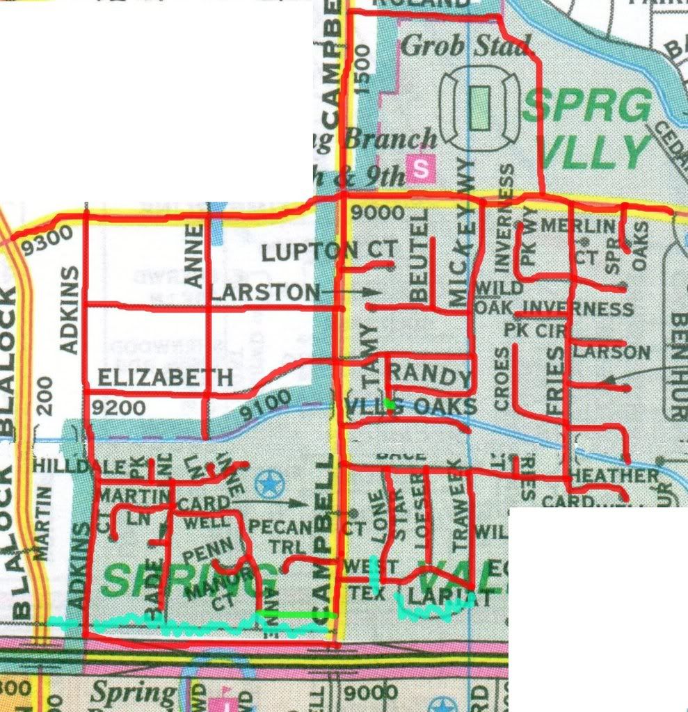
Notice the jagged aqua lines along the bottom of this map. As mentioned in an earlier Spring Valley expedition, a lot of Spring Valley disappeared when TXDoT widened the freeway. This was especially bad here, where in addition to ripping out lots of houses and all of Old Katy Road, the destruction left a bunch of "dead" spaces--spaces that can't easily be turned into useful (read tax-paying) properties. For example, this muddy little cut-through between Campbell and Anne:
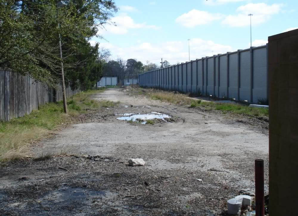
Lovely, isn't it? What can this land be used for? I suppose Spring Valley could build a narrow two-lane street, but would it serve a useful purpose? Can anything be built here? Notice the concrete noise wall. These walls loom over many neighborhoods. On the map, you can see the charmingly named circular street Lariat--a lariat no longer. It dead-ends into a noise wall. The residents at the end of Bade have this cheery sight to greet them after a hard day's work:
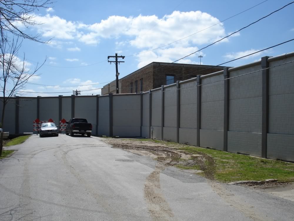
At the very least, Spring Valley should permit (and even encourage) painting these walls a different color than gulag grey. Perhaps murals could be created--give graffiti artists official license to beautify the walls. I'd support that, of course. The residents of Spring Valley--maybe not. But they can't be pleased with the oppressive structures they must live with.
One of the most prominent buildings in Spring Valley is the old Spring Branch High School.
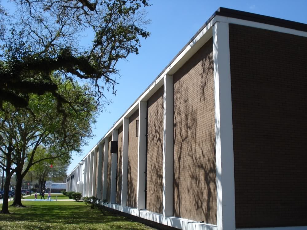
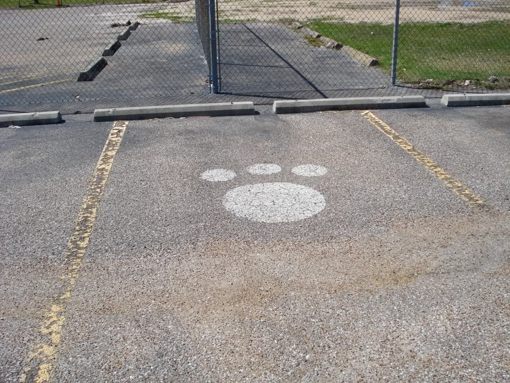
This was the eponymous Spring Branch ISD high school until 1985, when it and Westchester High School were both closed due to declining student enrollment in the district. (Rumors are afoot that they will reopen Westchester.) My sister was at Memorial High School then and recalls that the Spring Branch High Schoolers who transfered over were rather dispirited, and that the Mem High administration did nothing to make their transition easier. That said, I believe that the former Bears brought over one of their oldest traditions--painting bear paws on the school driveway. They changed it to horseshoes for the the Memorial Mustangs, but in a way, a little Bear spirit lived on. (This bear paw is in the parking lot for Grob Stadium.)
Now the building is used for the Cornerstone Academy, the "School of Choice" and for community education. The School of Choice appears to be something like some of the specialized high schools in HISD, and they have kept the Bears as their team name. The Cornerstone Academy with which it shares the campus is a charter middle school.
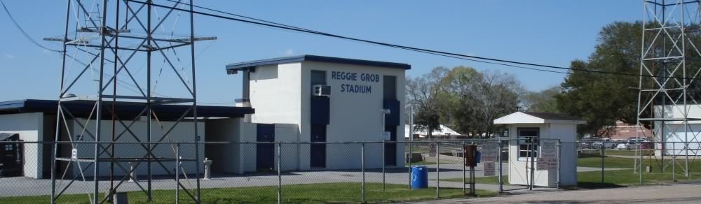
Behind the school is what I think was the main stadium for Spring Branch ISD before Tully Stadium was built out on Dairy Ashford. This is Reggie Grob Stadium--I have memories of playing here (and getting our asses kicked--go Eagles!) in junior high.
Right next to the old high school is a new early education facility--The Bear Boulevard School. The architecture is modern and playful.
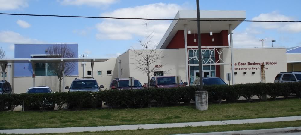
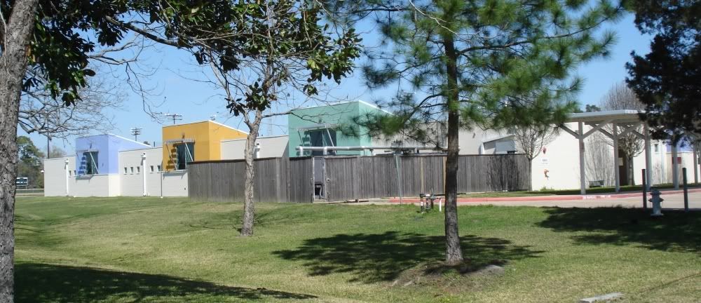
Spring Branch ISD must have wanted to get their money's worth from the architect, because three other pre-schools are built with the exact same design, the Lion Lane School, the Tiger Trail School, and the Wildcat Way School. The schools are visually pleasing, so I can't complain too much if they used the design more than once.
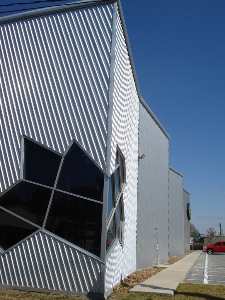
Around the corner from the High School is the Texas Rock Gym, a building with an aversion to right angles.
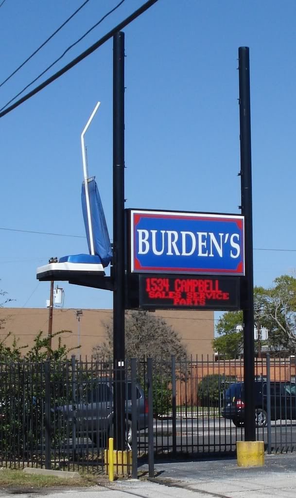
And just a couple of doors up from it is Burden's. I love this sign because I generally approve of any sign that visually represents what the business is offering. Particularly, as in this case, where the representation is completely realistic, but hugely out of scale.
Traveling south on Campbell, we come across an extremely unlikely business for this part of town.
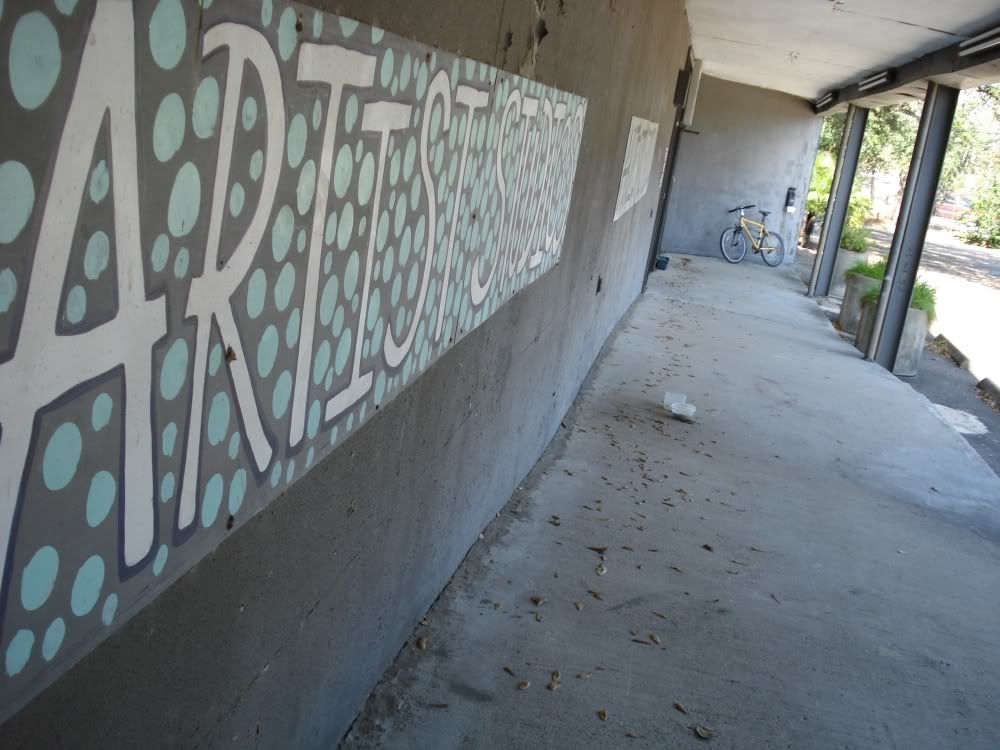
This is the kind of enterprise you expect to find inside the Loop. I am curious about the art that is produced here--is it interesting? I would suggest that the owner of the building would have better luck attracting artists if he or she put a nice interesting sculpture out in front of the building--that would send the right signal to potential tenants. If you are a westside artist lacking studio space, they do have vacancies.
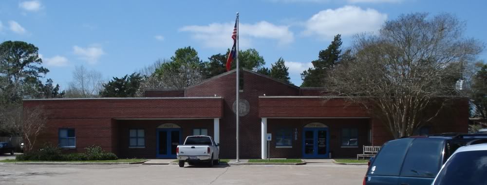
Further south on Campbell, we have Spring Valley's city hall, a tasteful postmodern structure.
But no one notices the city hall first, because right next to it is this:
The city hall building is dwarfed by this very white water (?) tank. They were smart to paint a big Spring Valley logo on it.
I mentioned an ancient house on Bingle--here is another unexpected survivor over on Adkins. This tiny house (924 sq. ft.) was built in 1945 on a huge lot (45,608 sq. ft.). The lot is so big that the owners built a second house on the same lot in 1975. But both houses are owned by one person and the whole property is considered to be a single property by Harris County. This is one of those anachronisms that somehow has avoided being subdivided and turned into a more standard suburban neighborhood.

Further up Adkins (and just outside of Spring Valley) is this stockaded house.
The wall consists of cedar stakes held up by wire. All the lots in Campbell Place (between Adkins and Campbell east and west, and Westview and Elizabeth north and south) are huge--and this stockade-like wall extends a hundred or so feet down Adkins.
As you can guess from the map, the lots in Campbell Place are enormous. Older houses tend to be fairly modest, but whenever someone builds a new one, they tend to be quite large--which is appropriate given the size of the lots. This modern house is the only corrugated-exterior house I've seen outside the Loop (although I'm sure there must be more). This look is inexplicably popular for townhouses inside the Loop, and I have to say that it seems to work pretty well with townhouses. But this house looks perhaps more industrial than I would like, perhaps due to its rather severe shape.
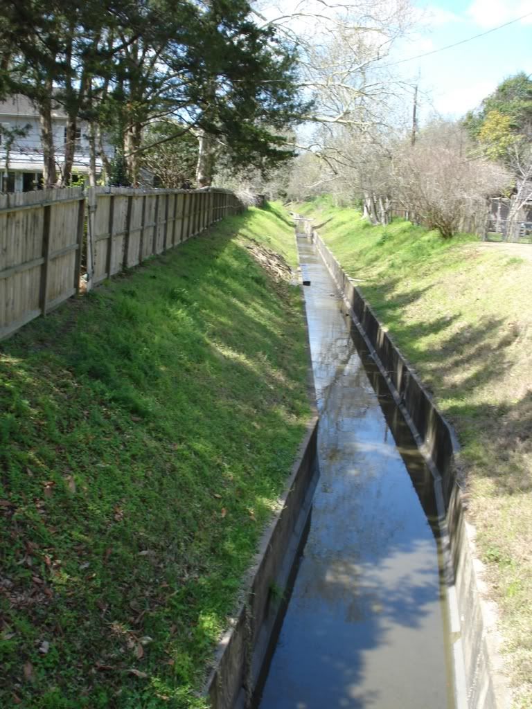
My Key Map is not only out of date regarding the freeway expansion, but it also wrongly implies that you can drive across Briar Branch Creek on Tamy. Apparently you cannot anymore (although the bridge is accessible by pedestrians and cyclists). But the change must be fairly recent, because the village seems particularly worried that you might try--hence the abundant warning signage.
Briar Branch Creek at this point upstream is brutally channelized, as you can see from this view facing east from the Fries bridge.
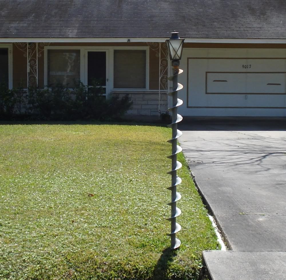
If you go north a couple of blocks from the Tamy bridge to Elezabeth, you'll see this elegant bit of recycling.
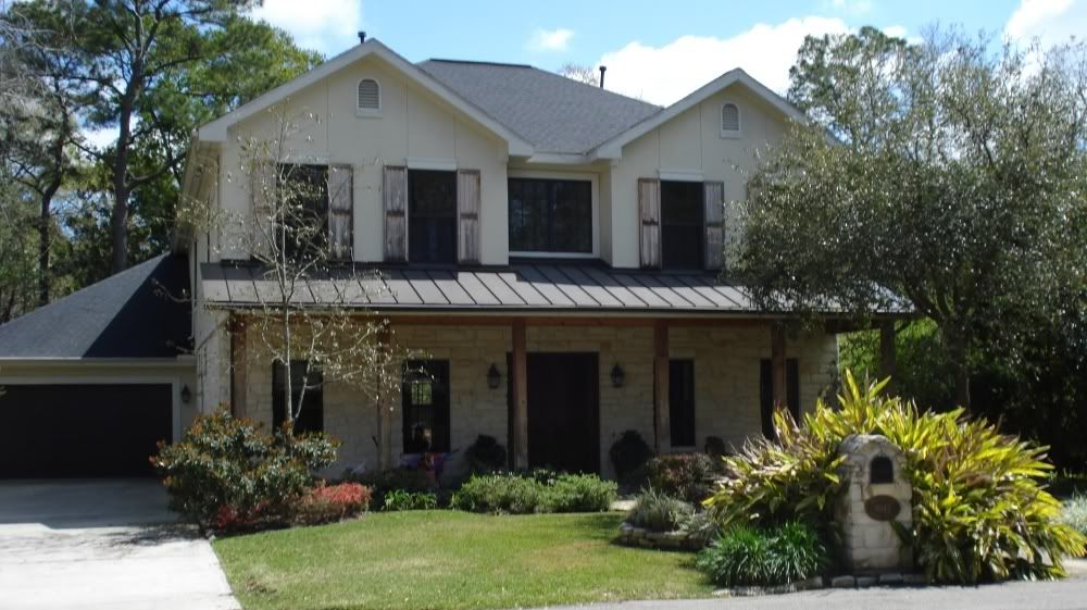
It's sometimes the small things like this that make a difference. Take this house on Croes, where the (deliberately?) weathered wood gives it a pleasant rustic look.
One final modern house to end my trek through the six Villages. Generally speaking, this house looks like a lot of other modern houses in this area (not to mention the Bear Boulevard School) with its flatiron-like angled roof elements. But the small bit of curved roof over the entryway really caught my eye. I don't think I've seen anything like it. It is small and only calls attention to itself by virtue of its anomalousness.
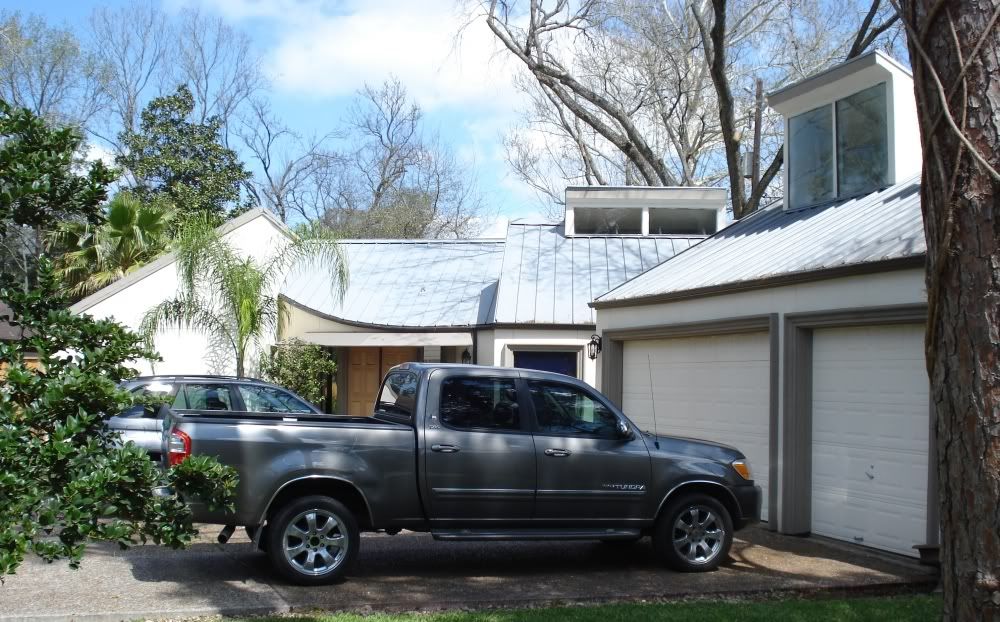
Perhaps this is a good way to characterize the Memorial Villages. They will tolerate eccentricity, but only a very small amount of it.
These are wealthy folks, and I bet many of them consider themselves to be individualists. Let your freak flags fly! You live in the Villages--you've made it. So do something wild and unique with your house and yard that proclaims your uniqueness.
Update: A reader sent me a correction--the creek I had referred to as Hunters Creek is really Briar Branch Creek (corrected above). Let me also toss out a request: is there a good map online that shows creek names in Houston? I haven't found one, and I am constantly getting these names wrong.
Notice the jagged aqua lines along the bottom of this map. As mentioned in an earlier Spring Valley expedition, a lot of Spring Valley disappeared when TXDoT widened the freeway. This was especially bad here, where in addition to ripping out lots of houses and all of Old Katy Road, the destruction left a bunch of "dead" spaces--spaces that can't easily be turned into useful (read tax-paying) properties. For example, this muddy little cut-through between Campbell and Anne:
Lovely, isn't it? What can this land be used for? I suppose Spring Valley could build a narrow two-lane street, but would it serve a useful purpose? Can anything be built here? Notice the concrete noise wall. These walls loom over many neighborhoods. On the map, you can see the charmingly named circular street Lariat--a lariat no longer. It dead-ends into a noise wall. The residents at the end of Bade have this cheery sight to greet them after a hard day's work:
At the very least, Spring Valley should permit (and even encourage) painting these walls a different color than gulag grey. Perhaps murals could be created--give graffiti artists official license to beautify the walls. I'd support that, of course. The residents of Spring Valley--maybe not. But they can't be pleased with the oppressive structures they must live with.
One of the most prominent buildings in Spring Valley is the old Spring Branch High School.
This was the eponymous Spring Branch ISD high school until 1985, when it and Westchester High School were both closed due to declining student enrollment in the district. (Rumors are afoot that they will reopen Westchester.) My sister was at Memorial High School then and recalls that the Spring Branch High Schoolers who transfered over were rather dispirited, and that the Mem High administration did nothing to make their transition easier. That said, I believe that the former Bears brought over one of their oldest traditions--painting bear paws on the school driveway. They changed it to horseshoes for the the Memorial Mustangs, but in a way, a little Bear spirit lived on. (This bear paw is in the parking lot for Grob Stadium.)
Now the building is used for the Cornerstone Academy, the "School of Choice" and for community education. The School of Choice appears to be something like some of the specialized high schools in HISD, and they have kept the Bears as their team name. The Cornerstone Academy with which it shares the campus is a charter middle school.
Behind the school is what I think was the main stadium for Spring Branch ISD before Tully Stadium was built out on Dairy Ashford. This is Reggie Grob Stadium--I have memories of playing here (and getting our asses kicked--go Eagles!) in junior high.
Right next to the old high school is a new early education facility--The Bear Boulevard School. The architecture is modern and playful.
Spring Branch ISD must have wanted to get their money's worth from the architect, because three other pre-schools are built with the exact same design, the Lion Lane School, the Tiger Trail School, and the Wildcat Way School. The schools are visually pleasing, so I can't complain too much if they used the design more than once.
Around the corner from the High School is the Texas Rock Gym, a building with an aversion to right angles.
And just a couple of doors up from it is Burden's. I love this sign because I generally approve of any sign that visually represents what the business is offering. Particularly, as in this case, where the representation is completely realistic, but hugely out of scale.
Traveling south on Campbell, we come across an extremely unlikely business for this part of town.
This is the kind of enterprise you expect to find inside the Loop. I am curious about the art that is produced here--is it interesting? I would suggest that the owner of the building would have better luck attracting artists if he or she put a nice interesting sculpture out in front of the building--that would send the right signal to potential tenants. If you are a westside artist lacking studio space, they do have vacancies.
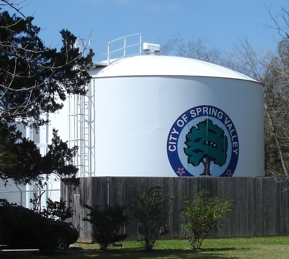
Further south on Campbell, we have Spring Valley's city hall, a tasteful postmodern structure.
But no one notices the city hall first, because right next to it is this:
The city hall building is dwarfed by this very white water (?) tank. They were smart to paint a big Spring Valley logo on it.
I mentioned an ancient house on Bingle--here is another unexpected survivor over on Adkins. This tiny house (924 sq. ft.) was built in 1945 on a huge lot (45,608 sq. ft.). The lot is so big that the owners built a second house on the same lot in 1975. But both houses are owned by one person and the whole property is considered to be a single property by Harris County. This is one of those anachronisms that somehow has avoided being subdivided and turned into a more standard suburban neighborhood.
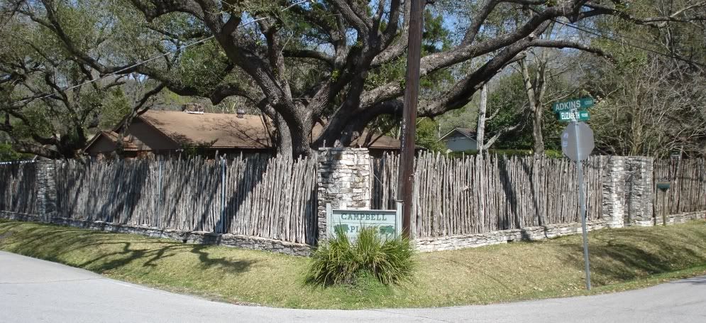
Further up Adkins (and just outside of Spring Valley) is this stockaded house.
The wall consists of cedar stakes held up by wire. All the lots in Campbell Place (between Adkins and Campbell east and west, and Westview and Elizabeth north and south) are huge--and this stockade-like wall extends a hundred or so feet down Adkins.
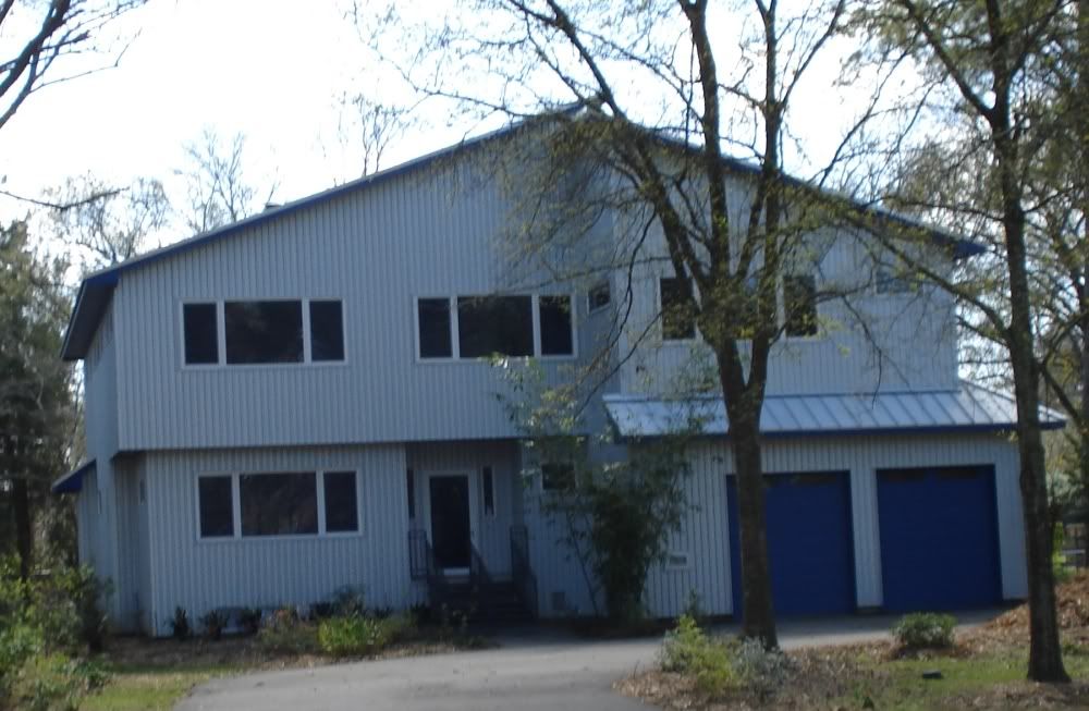
As you can guess from the map, the lots in Campbell Place are enormous. Older houses tend to be fairly modest, but whenever someone builds a new one, they tend to be quite large--which is appropriate given the size of the lots. This modern house is the only corrugated-exterior house I've seen outside the Loop (although I'm sure there must be more). This look is inexplicably popular for townhouses inside the Loop, and I have to say that it seems to work pretty well with townhouses. But this house looks perhaps more industrial than I would like, perhaps due to its rather severe shape.
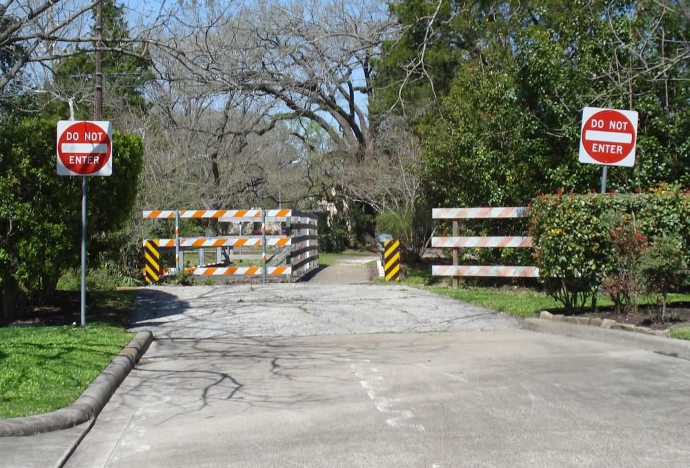
My Key Map is not only out of date regarding the freeway expansion, but it also wrongly implies that you can drive across Briar Branch Creek on Tamy. Apparently you cannot anymore (although the bridge is accessible by pedestrians and cyclists). But the change must be fairly recent, because the village seems particularly worried that you might try--hence the abundant warning signage.
Briar Branch Creek at this point upstream is brutally channelized, as you can see from this view facing east from the Fries bridge.
If you go north a couple of blocks from the Tamy bridge to Elezabeth, you'll see this elegant bit of recycling.
It's sometimes the small things like this that make a difference. Take this house on Croes, where the (deliberately?) weathered wood gives it a pleasant rustic look.
One final modern house to end my trek through the six Villages. Generally speaking, this house looks like a lot of other modern houses in this area (not to mention the Bear Boulevard School) with its flatiron-like angled roof elements. But the small bit of curved roof over the entryway really caught my eye. I don't think I've seen anything like it. It is small and only calls attention to itself by virtue of its anomalousness.
Perhaps this is a good way to characterize the Memorial Villages. They will tolerate eccentricity, but only a very small amount of it.
These are wealthy folks, and I bet many of them consider themselves to be individualists. Let your freak flags fly! You live in the Villages--you've made it. So do something wild and unique with your house and yard that proclaims your uniqueness.
Update: A reader sent me a correction--the creek I had referred to as Hunters Creek is really Briar Branch Creek (corrected above). Let me also toss out a request: is there a good map online that shows creek names in Houston? I haven't found one, and I am constantly getting these names wrong.
Labels: 77055, Houston Streets
posted by Robert Boyd at
7:19 AM
![]()

2 Comments:
Three things I know:
Burden's is the best vacuum store I know of. If you need it they have it. And they know what it is. "Hey I need this round black thingee for my Hoover that's pink." They have four of them.
The "Artists Studio" has been there, with the same sign, forever. Also, there has been the same "studio for rent" sign out there for at least 10 years that I know of for sure. I called once just to see what their rates are... more than my mortgage.
The stockade house? Always loved the fence, always wondered how it ended up there.
Your walking tour is great - it is like looking at my own life through someone else's lens. Keep it up.
Thanks!
Just to be clear--it's a biking tour, not a walking tour. This is kind of deliberate. I love exploring neighborhoods by any means, so I could have done this by car--but you tend to miss a lot of stuff when you are driving (at least I do), and your are somewhat limited about where you can go. I could have done it by foot, but that would take a really, really long time. So bicycle is my compromise.
That's hilarious about the art studios--my experience with these kinds of places (which is fairly extensive because I have always been kind of a fringe member of the art scene wherever I've lived) is that they were really really cheap. Hence in many of them, artists would illegally live in their studios.
Thanks for reading.
Post a Comment
Subscribe to Post Comments [Atom]
<< Home