Houston Streets 6

Yesterday I decided to take a break from exploring the Villages, and indeed from exploring the streets at all. It has always been my intention to look for all the paths a bicycle can take, even if a car can’t. That includes the little cut-throughs I’ve found in the Villages, but also short cuts through business parking lots, footbridges, and, of course, hike-and-bike paths. Perhaps the single best bike path in

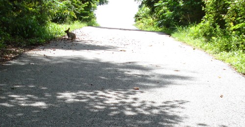
The trail starts on the east side of the Sam Houston Tollway, but I encountered a problem almost instantly. The Bayou is still running very high from the recent rains. The trail dips low under the freeway—with the result pictured above. The flooded part was just too deep for me to ford. I tried! So I had to go back into the neighborhoods north of the bayou and see if there was another way to access the park.
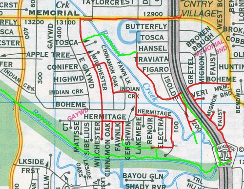
As you can see, I had to explore quite a bit to figure out a way to return to the bike path. (The green lines show paths inaccessible by car.) That said, there are numerous ways to get to
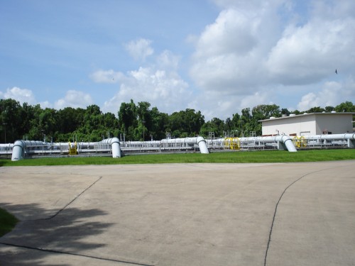
Still, it took a lot of exploring for me to find access to the bike trail. First I stumbled across this immense water treatment plant (which was accessible only by going to the end of nondescript suburban cul-de-sac, squeezing through a gate that one was obviously not meant to squeeze through, and crossing a one lane bridge). I later discovered that the trail runs just behind this plant, but I couldn’t find a way to get from the plant to the trail. So I kept searching.
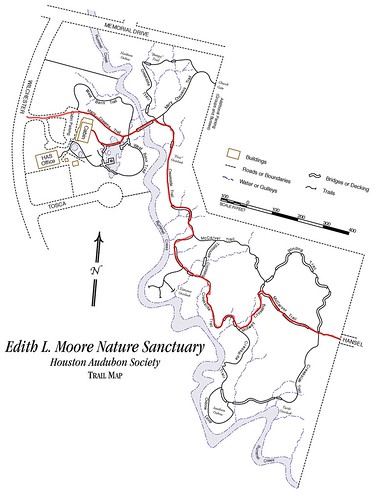
I then found an entrance into the Edith L. Moore Nature Preserve. This bird sanctuary is criss-crossed with trails (but bikes are not permitted—I compromised by walking my bike). It’s a beautiful little area of wilderness straddling Rummel Creek. I thought certainly it would connect to
It was quite wet and humid in the Preserve, and mosquitos dined on me with gusto. Despite that, I have to say it was quite beautiful, and it was here that I saw the first of four rabbits I would see that day. But I was no closer to the trail than when I’d entered the park.
I checked my map and headed south. It was on
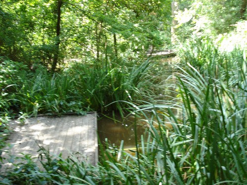
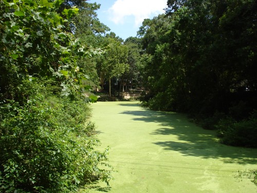
Instead of ending up on the bike trail, I ended up taking a path across two narrow concrete bridges spanning two small ponds (one pictured above). One pond was covered with duck weed and the other not. Looking north from the bridges, you could see houses lining them. Aside from the mosquitos and occasionally piece of floating litter, it was quite nice. I continued down the path and ended up at a short stairway up a bank that brought me to a small parking lot. This was the lot for the Memorial Glenn Pool and Tennis Club. This small neighborhood club was located at the end of a very long driveway—which bordered the water-treatment plant that I had seen earlier. And there was a little rude footpath that took me straight to the Terry Hershey bike path.
What excited me about these discoveries made trying to gain access to Terry Hershey Park is that without a certain amount of nosiness and blind stumbling around, I would have never discovered the two ponds, the swim club, or the water treatment plant. It is my belief that
I finally was back on the bike path, and I saw my second rabbit of the day.
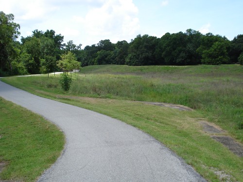
Terry Hershey park is full of lovely meadows like this one. And note the non-flat topography—this is one of the few landscapes in
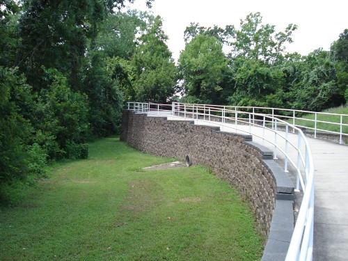
This is the Jake Hershey bridge (he was Terry’s husband).
Just east of
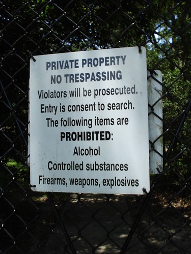
Update: It appears that this may not be a gated community. My brother, who works nearby, says it may be a highly secretive and security-obsessed Exxon Chemical facility. It's obviously not a chemical plant, but perhaps it is a laboratory of some kind. If so, and if any of the chemicals stored there are explosive, inflammable, or toxic, their fear of guns and explosives would be totally justified.
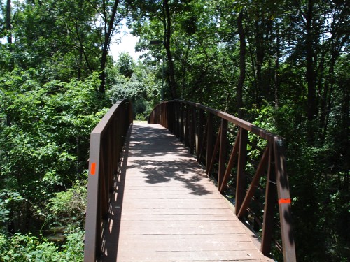
On the other side of South Mayde Creek, the trail crosses Buffalo Bayou and runs along its south side until you get to Highway 6. This is the bridge across the bayou. I wonder if there are any other footbridges across Buffalo Bayou?
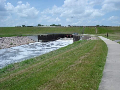
Finally you cross Highway 6 and reach Addicks Dam, the end of the line for the trail. Sort of. There are actually bike trails along Addicks Dam heading north and south from the Terry Hershey trailhead. How far they go, I don’t know—I was too tired to keep exploring yesterday.
Addicks Dam is used to control the flow of water into Buffalo Bayou. Behind the dam is Barker Reservoir and a relatively new park,
Labels: 77024, 77077, 77079, Buffalo Bayou, Houston Streets
posted by Robert Boyd at
6:53 PM
![]()

1 Comments:
I think that you arrived at the Barker dam, not addicks. I was also confused about this. Great post. I can't wait to get our there and explore this more. Thanks for introducing me to these trails.
Post a Comment
Subscribe to Post Comments [Atom]
<< Home